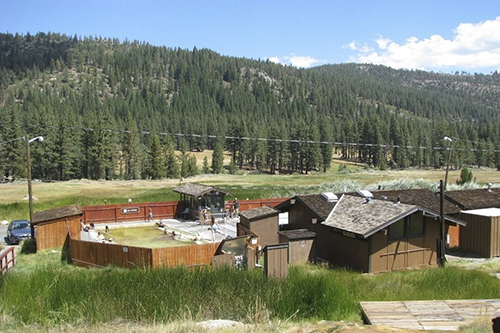
Only 35 minutes from Gardnerville, the 700-acre park lies in Hot Springs Valley at an elevation of nearly 6,000 feet, with mountains rising abruptly on three sides. Hawkins Peak, at 10,023 feet, is three miles northwest of the valley, and Markleeville Peak 9,417 feet, lies four miles to the southwest.
• One-mile self-guided loop trail, with descriptions of the area's natural history begins at the Campground Bridge.
• Charity Valley Trail - an additional hike is from the extra vehicle parking area where you can access the Charity Valley Trail. There are three options: either to the water falls (1.5 miles), to Burnside Lake (5 miles) or Charity Valley (6 miles). Trail markers identify the three trails available.
One of the park's two concrete pools is fed by the runoff from six mineral springs with an average temperature between 102 and 104 degrees F. The park has 76 sites equipped with fire pits and grills, cupboards, bear-proof lockers and tables. Two of the 76 sites are designed specifically for wheelchair use.
Driving Directions: Take SR-88 South to Woodfords. Turn left onto SR-89 to Markleeville. In the middle of Markleeville, take the paved road west for about four miles to the park. Parking fee.


